Search Results -

NAVIONICS+ Regular – MEDITERRANEE OUEST NAEU010R

NAVIONICS+ Regular - MEDITERRANEE OUEST

Les cartes Navionics+ Regular - MEDITERRANEE OUEST fournissent des données cartographiques pour les eaux côtières et intérieures, notamment sur les rivières, les baies et plus de 42 000 lacs dans le monde. Cette solution tout-en-un offre des cartes claires et fiables pour le plus grand choix de marques de traceurs. ______________________________________________________________________________________________________________________________________________________________

L'ABONNEMENT NAVIONICS+

Un abonnement de 12 mois aux Mises à jour illimitées et aux fonctions avancées est inclus à l'achat d'une solution cartographique Navionics+. Au bout d'un an, vous pouvez renouveler l'abonnement à un prix réduit.

CARTES ET MISES À JOUR

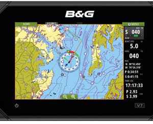
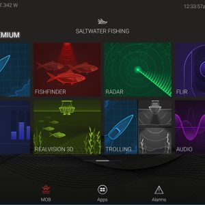
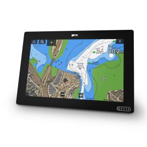
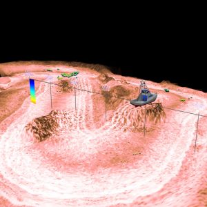
Carte Nautique – Des cartes complètes compilées à l'aide de plusieurs sources officielles, gouvernementales et privées, et présentées de manière intuitive. Cartes bathymétriques SonarChart HD – Des cartes bathymétriques innovantes avec isobathes tous les 0,5 m (1 pi), créées à l'aide de systèmes propriétaires Navionics qui enrichissent le contenu existant grâce à des données de sondeur fournies par la communauté de plaisanciers. Community Edits – De précieuses informations issues des modifications apportées par les utilisateurs de l'appli Navionics Boating, disponibles sur votre appareil connecté compatible. Mises à jour illimitées – Jusqu'à 5 000 mises à jour quotidiennes de nos cartes, pour vous donner les données les plus précises et les plus récentes disponibles.

FONCTIONS AVANCÉES

Guidage Dock-to-dock– Commencez votre voyage en suivant une suggestion de route. Option Carte Perso – Personnalisez votre affichage pour vous concentrer sur les détails les plus importants. Plotter Sync– Transférez des routes et des waypoints, mettez à jour vos calques de carte, etc. entre votre traceur compatible et l'appli Boating. Fonction de cartographie SonarChart Live – Suivez le traçage en temps réel de nouvelles cartes de profondeur HD quand votre bateau se déplace.

ZONES DE COUVERTURE

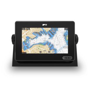
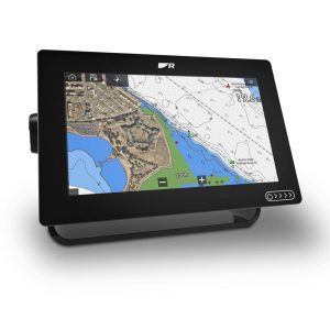
Une couverture cartographique mondiale est disponible, avec un contenu intégré qui facilite la sélection des fonctions de navigation et des régions de la carte. Choisissez votre couverture parmi des zones très étendues et des cartes plus localisées

COMPATIBILITÉ

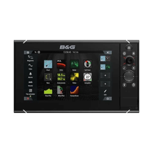
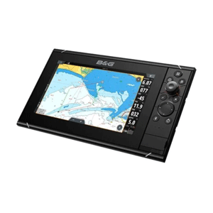
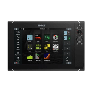
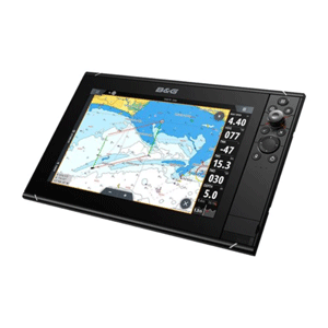
Vérifiez que le contenu et les fonctions Navionics+ sont compatibles avec votre traceur.
1 Abonnement requis.
2 Le guidage ne doit être utilisé qu'à des fins de planification et ne remplace en aucun cas une navigation prudente.
3 Abonnement non requis pour la fonction de cartographie SonarChart Live sur certains modèles de traceurs ; nécessite la dernière version du logiciel du traceur
.
REMARQUE : les cartes Navionics+ et Platinum+ ne sont pas compatibles avec les traceurs Garmin
Navionics+ Platinum+

Contenu Eaux côtières

- -
Contenu Eaux intérieures > 42 000 lacs >42 000+ lacs
Cartes nautiques détaillées - -
Cartes bathymétriques SonarChart™ HD - -
Mises à jour illimitées1 - -
Guidage Dock-to-dock1,2 - -
Plotter Sync1 - -
Community Edits - -
Option Carte Perso1 - -
Cartes SonarChart™ Live3 - -
Relief Shading1 -
Superposition images satellites avec SonarChart™ Shading1 Via Chart Installer
Photographie aérienne -
Vue 3D -
Read more...

SIMRAD Cruise range

SIMRAD Cruise range

SIMRAD Cruise: the most intuitive and easy-to-use chartplotter available

Simrad Yachtinga leading designer and manufacturer of high-end marine navigation, autopilot, radar, communications and sonar systems, recently announced the launch of the Simrad Cruise range of intuitive chartplotters. Cruise is designed to be easy to navigate, with an easy-to-use interface, screens, calipers and sensors that are visible even in bright sunlight.

Gamme SIMRAD Cruise

SIMRAD Cruise: for yachtsmen!

Simrad Cruise combine des fonctions GPS de base avec des fonctions de détection de profondeur pour offrir une navigation sûre et fiable à un prix abordable. Puisqu'il n'y a pas de sonar et de fonctions de réseau spécifiques à la pêche, Cruise n'exige pas que le rameur maîtrise des systèmes électroniques complexes. L'interface utilisateur est contrôlée par un clavier et un sélecteur rotatif pour faciliter la navigation dans les menus. Il fournit des informations de base pour passer un moment agréable et en toute sécurité sur l'eau: vitesse, profondeur, localisation GPS, itinéraire, niveau de batterie et informations sur la température. Les utilisateurs peuvent également choisir parmi une variété d'options de cartographie, y compris C-MAP et Navionics, qui incluent des fonctionnalités avancées telles que Easy Routing de C-MAP, qui offrent une véritable expérience de navigation de type voiture.

Find all SIMRAD products!

Find out more about SIMRAD products

Common features :

  • Navigate with confidence thanks to the easy-to-use rotary control, intuitive keypad and simple menus
  • Intuitive menus, easy-to-use rotary control wheel and control keypad
  • Preloaded world map background
  • Prise en charge d'une large gamme de cartes améliorées C-MAP® et Navionics®
  • Pre-selected shared screens to keep important data in view
  • Displays depth, position, battery voltage, etc.
Screen size 5 inches 7 inches 9 inches
Screen definition 800 x 480 pixels 800 x 480 pixels 800 x 480 pixels
Backlighting Led 800 nits Led 1000 nits Led 1000 nits
Card reader 1 Micro SD slot, max. 32GB 1 Micro SD slot, max. 32GB 1 Micro SD slot, max. 32GB
Radar compatible No No No
Dimensions 184.5 mm x 142.3 x 117.9 mm 263 mm x 145.5 x 100 mm 311 mm x 165.8 x 92.6 mm
Waterproofing IPX 6 & 7 IPX 6 & 7 IPX 6 & 7
Integrated GPS 1 Hz Yes Yes Yes
Read more...

B&G Vulcan range

B&G VULCAN range

Gamme B&G VULCAN

B&G Vulcan: a chartplotter for every navigator

The Vulcan series provides versatile, easy-to-use plotters with multi-touch zoom and pinch functions on a 7", 9" or 12" screen. B&G a fait du dernier Vulcan le traceur de cartes le plus brillant et le plus clair de sa catégorie. La série de traceurs de cartes de B&G Vulcan élimine les conjectures pendant le voyage. Que vous soyez un marin expérimenté ou un débutant, Vulcan dispose d'une multitude de fonctions pour vous aider à profiter au maximum de votre temps sur l'eau.
The Vulcan plotter designed by B&G is aussi intuitif qu'une tablette ou un smartphone. Même en plein soleil, vous pouvez voir l'écran super lumineux et discret, même dans le brouillard ou la mer agitée, l'écran tactile réactif peut également fournir un contrôle du bout des doigts. Utilisez les commandes de pincement, de balayage et d'écran tactile pour saisir facilement des waypoints et des itinéraires et afficher les détails de la carte. Laissez Vulcan vous guider en toute sécurité jusqu'à votre destination: placez des waypoints et des itinéraires en un seul clic sur la carte, laissez Vulcan vous fournir des illustrations et des données graphiques claires et intuitives. Ajoutez une cartographie compatible pour le routage automatique et laissez le logiciel intelligent de Vulcan choisir l'itinéraire le plus sûr et le meilleur pour votre destination.
Gamme B&G VULCAN

Find all the B&G brand products!

Find out more about B&G products

Common features :

  • Easy-to-use multitouch screen
  • Dedicated navigation functions for yachting and racing: SailSteer, SailingTime, RacePanel, Laylines
  • Simplicité d'intégration : branchez Vulcan à votre système existant pour y ajouter des composants de navigation de bas
  • Broadband Radar and ForwardScan compatible
  • Integrated Wi-Fi
  • Controlling your B&G driver
  • Affichage des données d'instruments
Screen size 7 inches 9 inches 12 inches
Screen definition 800x480 pixels 800 x 480 pixels 1280 x 800 pixels
Backlighting Led 1200 nits Led 1200 nits Led 1200 nits
Integrated 10 Hz GPS Yes Yes Yes
Cards supported Insight, Navionics (Gold, NAV+, Platinum+) , C-MAP (MAX N, MAX N+) NV Digital (Raster US Charts) Insight, Navionics (Gold, NAV+, Platinum+) , C-MAP (MAX N, MAX N+) NV Digital (Raster US Charts) Insight, Navionics (Gold, NAV+, Platinum+) , C-MAP (MAX N, MAX N+) NV Digital (Raster US Charts)
Radar, AIS, Integrated Pilot compatible Yes Yes Yes
Waterproofing IPX6/IPX7 IPX6/IPX7 IPX6/IPX7
Dimensions 197 mm x 141 mm x 82.7 mm 243 mm x 171 mm x 83 mm 310 mm x 219 mm x 82.7 mm
Weight 1.32 kg 1.32 kg 2,242 kg
Read more...
Gamme RAYMARINE AXIOM+

RAYMARINE AXIOM+ range

RAYMARINE AXIOM + range

AXIOM+ is the powerful new multifunction navigation system from Raymarine. The LightHouse 3 operating system is fast, fluid and easy to learn. The uncluttered interface can be easily customised to suit your browsing style.

Gamme RAYMARINE AXIOM+
RAYMARINE
It supports the best LightHouse cards and Navionics A fully glazed, reinforced display is optimised for flush or surface mounting. Elegant buttonless design for fingertip control Axiom+ is scalable. It supports the full range of Raymarine accessories, including Quantum radar, CHIRP sonar, FLIR thermal cameras, audio integration, instruments, cameras and Evolution autopilot.

Connectivity!

Its standardised Wi-Fi and Bluetooth connectivity enables it to connect to the latest Raymarine applications for tablets and smartphones. Axiom+ includes surface and bracket mounting kits, mounting hardware, power/data cable and installation instructions.
RAYMARINE

Find all the RAYMARINE products!

Find out more about RAYMARINE products here

Features common to all screens :

  • Wireless communication via Wi-Fi 802.11b/g/N
  • Bluetooth 2.1
  • NMEA 2000 compatible
  • IPX6/IPX7 waterproofing
  • Smart Mode: simultaneously switches the display of all network screens to a predefined mode
  • 10 HZ 72-channel GPS/GLONASS receiver
  • Radar compatible
  • Compatible with FLIR M100, M200 thermal imaging cameras
  • Compatible with IP video cameras (up to 10 video cameras)
  • Support for NMEA 2000-compatible audio devices
Screen size 7 inches 9 inches 12 inches
Screen type Multitouch WVGA Multitouch WVGA Multitouch WVGA (HD) IPS
Screen definition 800 x 480 pixels 800 x 480 pixels 1280 x 800 pixels
Case dimensions 21 x 14.2 x 7.7 cm 24.4 x 15.8 x 7.7 cm 31.4 x 21.7 x 7.7 cm
Integrated sounder module No

Compatible with CHIRP CP470/CP 570 modules

No

Compatible with CHIRP CP470/CP 570 modules

No

Compatible with CHIRP CP470/CP 570 modules

Transmitting power 600W
Weight 1.5 kg 2.04 kg 2.84 kg

All AXIOM Plus variants :

Read more...
Gamme LOWRANCE HOOK REVEAL

LOWRANCE HOOK REVEAL COMBINATION range

LOWRANCE HOOK REVEAL COMBINATION range

Simple and comprehensive, the new LOWRANCE HOOK Reveal is available with a 5", 7" or 9" 16:9 screen. The HOOK Reveal series is adaptable and can be transformed into a 2-in-1 (2D Sounder and DownScan) or 3-in-1 (2D Sounder, DownScan and Structure Scan) sounder, with CHIRP technology and a large cone opening.

Gamme HOOK REVEAL
LOWRANCE
Ces solutions de sondeur améliorées offrent une vision précise de l’environnement sous-marin sur des écrans larges, en indiquant notamment la position des poissons, la structure, la position des appâts, le tout à l’aide d’une sonde fournie. Entièrement automatisée, la série Reveal vous épargne la tâche de réglage de la sonde, avec un sondeur qui permet de créer des échos de poissons encore plus visibles tout en conservant la clarté et la séparation des cibles.

Find all LOWRANCE products!

Find out more about LOWRANCE products

Common features :

  • 16:9 TFT colour screen
  • Waterproof IPX7
  • 1 Micro SD slot
  • Compatible with NAVIONICS and C-Map maps
  • Integrated 10 Hz GPS
Screen size 5 inches 7 inches 9 inches
Screen type 16:9 TFT colour screen 16:9 TFT colour screen 16:9 TFT colour screen
Screen definition 800 x 400 pixels 800 x 400 pixels 800 x 400 pixels
Case dimensions 18.5 x 10.9 x 8.4 cm 23.6 x 16.4 x 8.4 cm 27.7 x 16.2 x 11.1 cm
2D Sounder Yes Yes Yes
DownScan Yes Yes Yes
StructureScan No Yes Yes
StructureScan 3D No No No
NMEA network No No No
Ethernet network No No No
Integrated 10 Hz GPS Yes Yes Yes

All the variants in the range

Read more...

LOWRANCE COMBINED HDS LIVE range

LOWRANCE COMBINED HDS LIVE range

After the HDS3 and CARBON series, LOWRANCE and the HDS LIVE series continues this tradition with exceptional performance. Active Imaging, StructureScan 3D and FishReveal are now all available from a single probe (Black Box module required for 3D acquisition). Dual-channel CHIRP probe enabling two depth scales to be covered from a single device.
LOWRANCE
LOWRANCE
Compatible with LiveSight echo sounder: Scan below and in front of the boat in real time. The heat zone map allows anglers to monitor trends in water temperature change to quickly target exceptional fishing areas. Enhanced Surface Clarity feature lets you spot more target fish near the surface The Quick Access Control Bar provides direct access to system commands.

Find all LOWRANCE products!

Find out more about LOWRANCE products

Common features :

  • High-definition SolarMax multitouch screen with exceptionally wide viewing angles.
  • High-performance 4-core processor
  • IPX6 and IPX7 sealing
  • Bluetooth wireless connectivity
  • NMEA 2000 motor interface
  • C-MapEasy Routing and Navionics Autorouting features
  • Smartphone notification
  • Integrated 10 Hz GPS
Screen size 7 inches 9 inches 12 inches
Screen type Solarmax Multitouch HD Solarmax Multitouch HD Solarmax Multitouch HD
Screen definition 1024 x 600 pixels 1280 x 720 pixels 1280 x 800 pixels
Ethernet network Yes Yes Yes
Card reader 2 micro SD slots 2 micro SD slots 2 micro SD slots
Radar compatible Yes Yes Yes
Lowrance autopilot Yes Yes Yes
StructureScan Yes Yes Yes
Multi-channel CHIRP module Yes Yes Yes
Live Sight Yes Yes No
Integrated 10 Hz GPS Yes Yes Yes
Screen size 16 inches
Screen type Solarmax Multitouch HD
Screen definition 1920 x 1080 pixels
Ethernet network Yes
Card reader 2 micro SD slots
Radar compatible Yes
Lowrance autopilot Yes
StructureScan Yes
Multi-channel CHIRP module Yes
Live Sight Yes
Integrated 10 Hz GPS Yes
Read more...
Gamme LOWRANCE ELITE FS

LOWRANCE ELITE FS range

LOWRANCE ELITE FS range

Complete and effective

Equipped with a high-accuracy Active Imaging™ fishfinder, FishReveal™ functionality, integrated Genesis Live real-time mapping and a display that offers more clarity and better target separation, the Elite FS is designed to help you locate fish more easily and make your life more enjoyable on the water, including an easy-to-use touchscreen, wireless connectivity, smartphone notifications and integration with front electric motors and Power Pole® anchors. Exclusive to the brand LOWRANCE.
Gamme LOWRANCE ELITE FS
LOWRANCE
With a 3-in-1 Active Imaging fishfinder (CHIRP, SideScan and DownScan) and a 2-in-1 fishfinder (SideScan and DownScan), the Elite FS enhances your fishing performance and offers a superior level of resolution, clarity and contrast at a distance unmatched by any other fishfinder in its class. and contrast at a distance unmatched by other fishfinders in its class. With Elite FS, you'll benefit from more powerful navigation features, including preloaded C-MAP® charts for basic global navigation, Easy Routing from C-MAP and Autorouting from Navionics.

Find all LOWRANCE products!

Find out more about LOWRANCE products

Common features :

  • SolarMax HD screen
  • IPX6 and IPX7 sealing
  • Bluetooth wireless connectivity
  • NMEA 2000 motor interface
  • Integration with front electric motors and Power Pole anchors
  • C-MapEasy Routing and Navionics Autorouting features
  • Smartphone notification
  • Integrated 10 Hz GPS
Screen size 7 inches 9 inches
Screen type Solarmax HD Solarmax HD
Screen definition 800 x 480 pixels 800 x 480 pixels
Ethernet network No No
Card reader 1 micro SD slot 1 micro SD slot
Radar compatible No No
Lowrance autopilot No No
StructureScan No No
Multi-channel CHIRP module No No
Live Sight No No
Integrated 10 Hz GPS Yes Yes

All ELITE FS variants available:

Read more...
Gamme FURUNO NAVNET TZT3

NAVNET TZT3 - FURUNO TZtouch3 range

FURUNO NAVNET TZT3 range

The new NavNet TZT3 multitouch displays, with their edge-to-edge glass screen, refined graphical user interface, GPS, depth sounder and integrated WiFi module, are a pleasure to use. Developed by FURUNO From the NavNet TZtouch2, the TZtouch3 has a new user interface to make it easier to use.

The NavNet TZT3 GPS, CHIRP sounder and integrated wifi multifunction displays are available in 9, 12 and 16-inch versions.

Gamme FURUNO NAVNET TZT3

[yotuwp type="playlist" id="PLSKua01rOzpn9QNg58BCTn8QE6kXzR2pA" ]

FURUNO
Que vous soyez à la recherche de spots de pêche, que vous traciez une route ou que vous utilisiez votre radar pour naviguer dans le brouillard, vous utiliserez une gestuelle simple et familière. Grâce à sa connectivité en WiFi, la NavNet TZT3 permet d’accéder gratuitement aux données météo en temps réel, aux “Community Charts”, aux services de donnée “Cloud” et plus,… Visualisez les informations de votre NavNet TZtouch3 et contrôler les sur vos appareils iOS ™ et Android.
The NavNet TZtouch is the only map reader on the market that offers users a choice of official NOAA raster or vector maps, "C-Map by Jeppesen" and "Datacore by Navionics" vector maps. You can load the satellite photo areas of your choice in ultra-high resolution. Thanks to PhotoFusionTM , the photo is at 100% intensity over land areas and as the depth increases, the photo becomes transparent. This allows you to accurately distinguish the different depth zones from the raster or vector mapping below.
FURUNO
FURUNO
An integrated sounder with new technology: RezBoost™: Separation of echoes close to the bottom and discrimination between each echo are improved. This technology simplifies the discrimination of individual echoes in a school of fish and allows you to distinguish alvins from predators. As this new technology is based on a technological advance in software, you can use standard probes already installed on your boat.
By connecting the appropriate Furuno sensors you gain access to various functions: Depth Nuance, PhotoFusion™ Satellite, AIS target tracking, Radar-Cartography Overlay, ARPA target tracking, Auto Digital Gain and Clutter Filter Control, Real-time Dual Scale Radar with Progressive Scan, ACCU-FISH™ (Fish Size Analysis), Bottom Discrimination....

Find all FURUNO products!

Find out more about FURUNO products

Common features :

  • MapMedia MM3D cartography in Raster and/or Vector format
  • Integrated WI-FI
  • Rezboost integrated depth sounder
  • Tightness IP56
  • Flushmount installation - optional bracket
  • Fusion Link Ethernet Nmea 2000
  • 12-24 VDC power supply
Screen size 9 inches 12 inches 16 inches
Screen type Multitactile WXGA 1280 x 720 Pixels Multitouch 1280 x 800 pixels Multitouch Full HD 1920 x 1080 pixels
Integrated depth sounder Yes Yes Yes
Integrated GPS Yes Yes Yes
Integrated Wifi Yes Yes Yes
NMEA2000 Yes Yes Yes
Brightness 1000 cd/m2 900 cd/m2 1000 cd/m2
Consumption NC 27,6 W 51,6 W
Read more...
Gamme GARMIN ECHOMAP UHD 42CV, 62CV, 72CV et 92SV

GARMIN ECHOMAP UHD 42CV, 62CV, 72CV and 92SV range

GARMIN ECHOMAP UHD 42CV, 62CV, 72CV and 92SV range

The GARMIN ECHOMAP UHD series: top-of-the-range GPS handsets with UHD scanning sounder

These new GPS handsets are packed with advanced features, such as support for ultra-high-definition scanning sonar technology from Garminand products such as the Panoptix LiveScope, all of which have smaller screens and lower prices. Affordable price. The new UHD series has sonar and graphics features that are unrivalled in its class. And with support for BlueChart g3 and BlueChart g3 Vision charts, Navionics integrated data fishers will benefit from the latest detailed charts.

Gamme GARMIN ECHOMAP UHD 42CV, 62CV, 72CV et 92SV
GARMIN ECHOMAP PLUS
GARMIN ECHOMAP PLUS
GARMIN ECHOMAP PLUS

Find all GARMIN products!

Discover GARMIN products here

Features of the GARMIN ECHOMAP UHD 42CV, 62CV, 72CV and 92SV range

  • See what's going on under your boat in incredible detail with the optional probe
  • Naviguez sur toutes les eaux du globe à l'aide de cartes en option
  • Manage your boat trips wherever you are, or almost wherever you are
  • Create your own maps on the fly and adapt them to your needs

Optional probe assembly

Choisissez un kit de transducteur, ajoutez un transducteur GT24 à votre système et utilisez le sonar à balayage ultra-haute définition ClearVü pour profiter d'images cristallines de ce qui se passe sous le bateau. De plus, vous obtiendrez le sonar haut et large traditionnel Garmin CHIRP, qui offre une excellente séparation des cibles.

Optional nautical charts

La carte côtière BlueChart g3 Vision avec contenu Garmin et Navionics est en option, et vous pouvez profiter d'une couverture et de détails inégalés.

Screen size 4.3 inches 6 inches 7 inches
Screen type WQVGA screen WVGA screen WVGA screen
Screen definition 480 x 272 pixels 480 x 800 pixels 400 x 800 pixels
Case dimensions 10.2 x 20.4 x 0.4 cm 21.8 x 13.0 x 6.2 cm 25 x 13.9 x 5.1 cm
Maximum depth 700 metres at 77 kHz, fresh water

335 metres at 77 kHz, salt water

(l'estimation de la profondeur dépend directement du type de fond et d'autres caractéristiques de l'eau)

700 metres at 77 kHz, fresh water

335 metres at 77 kHz, salt water

(l'estimation de la profondeur dépend directement du type de fond et d'autres caractéristiques de l'eau)

700 metres at 77 kHz, fresh water

335 metres at 77 kHz, salt water

(l'estimation de la profondeur dépend directement du type de fond et d'autres caractéristiques de l'eau)

CHIRP technology compatible Yes integrated Yes integrated Yes integrated
Compatible with ClearVü technology Yes with integrated CHIRP Yes with integrated CHIRP Yes with integrated CHIRP
SideVü technology compatible No No No
Number of probe pins 4 4 8
NMEA 2000 compatible No Yes Yes
NMEA 0183 input 1 1 1
NMEA 0183 output 1 1 1
Video input No No No
Video output No No No
Garmin Network ports No No 1 Panoptix port
Wireless connectivity No Yes Yes
ActiveCaptain compatible No Yes Yes
Power consumption 5W 12W 15W
Weight 0.7 kg 0.7 kg 0.77 kg
Screen size 9 inches
Screen type WVGA screen
Screen definition 400 x 800 pixels
Case dimensions 28.2 x 16.4 x 6.0 cm
Maximum depth 700 metres at 77 kHz, fresh water

335 metres at 77 kHz, salt water

(l'estimation de la profondeur dépend directement du type de fond et d'autres caractéristiques de l'eau)

CHIRP technology compatible Yes integrated
Compatible with ClearVü technology Yes with integrated CHIRP
SideVü technology compatible Yes with integrated CHIRP
Number of probe pins 12
NMEA 2000 compatible Yes
NMEA 0183 input 1
NMEA 0183 output 1
Video input No
Video output No
Garmin Network ports No
Wireless connectivity Yes
ActiveCaptain compatible Yes
Power consumption 18W
Weight 1.0 kg
Read more...
Gamme B&G Zeus 3S

B&G Zeus 3S range

B&G Zeus 3S range

B&G carte

Multifunction navigation screen

Zeus 3S is a full-featured chartplotter navigation system for offshore yachtsmen and regatta sailors. B&G. Available in a range of screen sizes, from the compact 7-inch format to the all-new 16-inch format, these ultra-bright, wide-angle displays combine touchscreen technology with a rotary selector and keypad to control all on-screen functions. Both control modes can be used simultaneously, or the Zeus 3S can be set to non-touch mode for reliable use in extreme conditions.
Benefit easily from dedicated navigation functions proven in racing and cruising situations such as SailSteer, Laylines and RacePanel: with SailSteer, view all navigation data on a single screen, laylines and tack angles superimposed on the charts and estimate your arrival time more accurately with Sailing Time, taking into account the hazards of a sailing trip. RacePanel offers a range of race-proven features including integration with B&G's H5000 tactical systems providing additional analytical and forecasting capabilities. The Zeus 3S connects to online services and mobile devices using built-in Wi-Fi and integrates seamlessly with a wide range of instruments and accessories to enhance safety, performance and enjoyment on the water.
B&G carte

Find all the B&G brand products!

Find out more about B&G products

Common features :

  • High-visibility SOLARMAX HD screen
  • Integrated Wi-Fi for easy access to graphics, weather, updates and screen mirroring
  • Integrated ForwardScan sounder module for safer passage in shallow waters
  • Smart Mode: simultaneously switches the display of all network screens to a predefined mode
  • 10 Hz GPS receiver
  • Integrated autopilot control
  • NMEA 2000, 0183, ETHERNET compatible
  • Video input and output
Screen size 9 inches 12 inches 16 inches
Screen definition 1280 x 720 pixels 800 x 1280 pixels 1920 x 1080 pixels
Backlighting Led 1200 nits Led 1200 nits Led 1200 nits
Integrated 10 Hz GPS Yes Yes Yes
Cards supported Insight, Navionics (Gold, NAV+ Platinum+) , C-MAP (MAX N, MAX N+,Reveal) NV Digital (Raster US Charts) Insight, Navionics (Gold, NAV+ Platinum+) , C-MAP (MAX N, MAX N+) NV Digital (Raster US Charts) Insight, Navionics (Gold, NAV+ Platinum+) , C-MAP (MAX N, MAX N+) NV Digital (Raster US Charts)
Radar, AIS, Integrated Pilot compatible Yes Yes Yes
Connection Ethernet, 1 x Micro C NMEA 2000, 1 x input, 1 x output NMEA 0183, sensor connection, 2 x composite video inputs Ethernet, 1 x Micro C NMEA 2000, 1 x input, 1 x output NMEA 0183, sensor connection, 2 x composite video inputs 2 x Ethernet, 1 x Micro C NMEA 2000, 1 x input, 1 x output NMEA 0183, sensor connection, 2 x composite video inputs
Waterproofing IPX6/IPX7 IPX6/IPX7 IPX6/IPX7
Dimensions 287 x 166 x 90 mm 352 x 225 x 98 mm 437 x 256 x 98 mm
Weight 1.41 kg 3.1 kg 4.65 kg
Read more...
You've just added this product to the cart:

en_GB